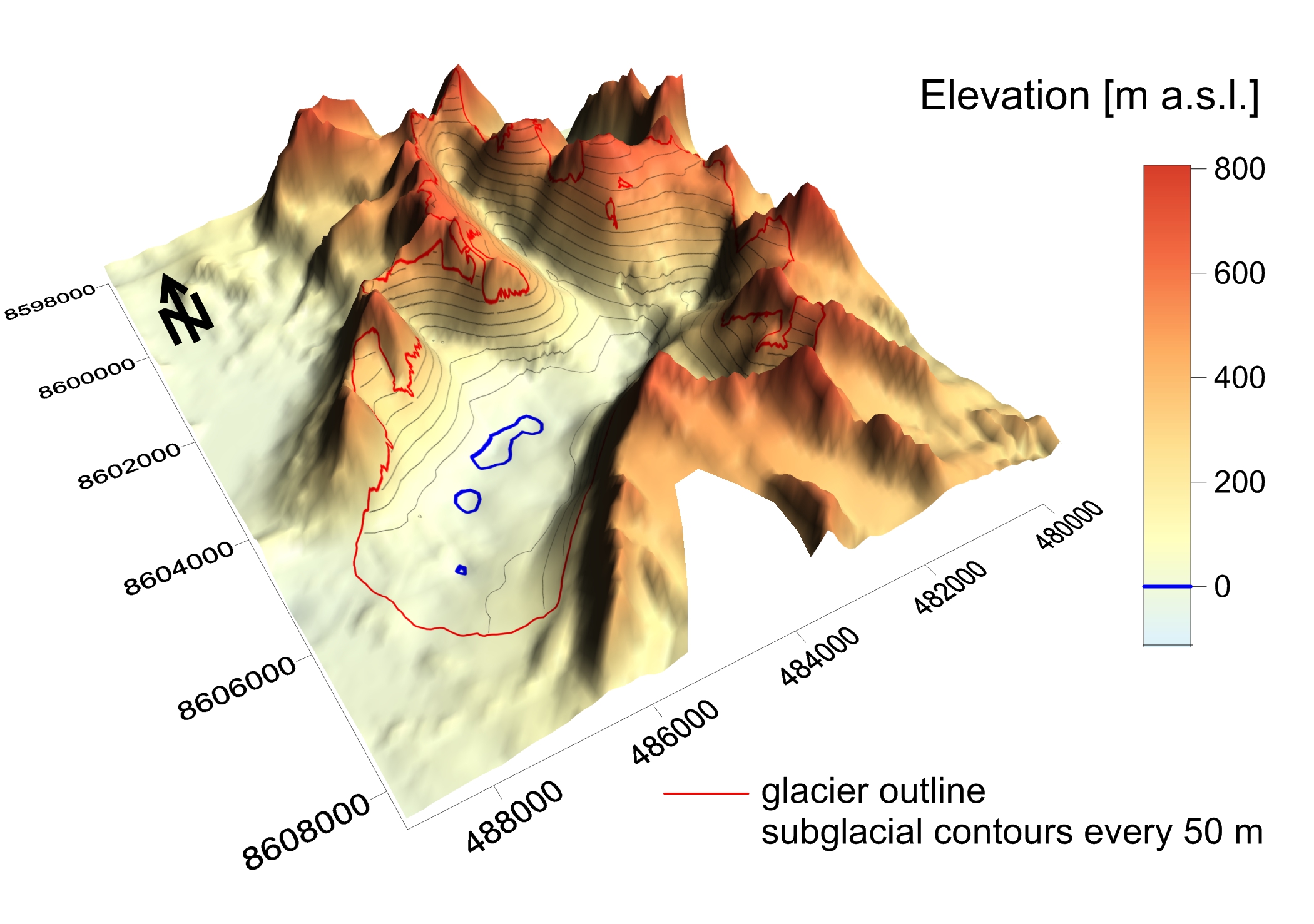
Ice-free topography of Renardbreen...
Topography based on: Grabiec M. 2017: Stan i współczesne zmiany systemów lodowcowych południowego Spitsbergenu w świetle badań metodami radarowymi. Wydawnictwo Uniwersytetu Śląskiego, 328 s. NORSK POLARINSTITUTT. Topografisk kart over Svalbard 1:100000, Blad B11 Van Keulenfjorden. Zagórski P., 2005: NW part of Wedel Jarlsberg Land (Spitsbergen, Svalbard, Norway). Orthophotomap 1 : 25 000. K. Pękala, H.F. Aas, eds. Lublin.
Additional Information
| Field | Value |
|---|---|
| Data last updated | January 31, 2025 |
| Metadata last updated | January 31, 2025 |
| Created | January 31, 2025 |
| Format | JPEG |
| License | No License Provided |
| Lead photo | |
| Datastore active | False |
| Datastore contains all records of source file | False |
| Has views | True |
| Id | 36140916-1322-4a3b-ba7a-ed2d1eb66237 |
| Package id | 9241ae56-8a67-4ee2-a47a-0ceeeb4934d3 |
| Position | 4 |
| State | active |