Help
POLISH POLAR DATABASE MANUAL
POLAR-PL SYSTEM
Polar-PL is Polish Polar DataBase (PPDB) portal, based on the CKAN data management system, which is used to collect, publish and share metadata about datasets, publications and Polish polar researchers. The basic Polar-PL ecosystem categories are: Datasets, Organizations (which allow to manage Datasets), and Groups, which are used to create collections by topic or specific use.


All portal users can search, view and visualize the collected data. Only registered users (editors) are granted to enter and edit metadata (more in the chapter “Metadata editing”).
All Polar-PL users can use its faceted search features to browse and find the data they need, and preview it using tables or images. Metadata about the data contains the title, description, authors, publisher, date, what formats it is available in, what license it is released under, etc.
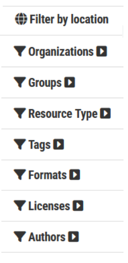
To find datasets, type any combination of search words in the search box on any page. You can also restrict the search to datasets with organizations, resource type, particular tags, data formats, etc using the filters in the left-hand column. Datasets are tagged by geographical area, so it is also possible to search and filter of datasets by selecting an area on a map.

To obtain editing permission in the Polar-PL website, please send an application to andrzej.glazewski(at)pw.edu.pl or pawel.kowalski(at)pw.edu.pl. The assigned user account will allow you to log in to the CENAGIS server, and the data stewards will assign the new user to the specified organization.
In CKAN system data is published in units called Datasets. The most popular resource types in dataset directory are: Datasets, People, Publications, Projects and Workgroups. Individual dataset contains two things: specific set of metadata and a number of Resources, which hold the data itself (files). System can store the resource internally in PPBD server, or store it as a link to the resource on the web.
Additional tools are also available on the Polar-PL. To view the spatial data of the Polish Polar DataBase you can use the Polar-PL MapViewer module (https://polarmap.cenagis.edu.pl/). A MapViewer is available for all users. Another tools: My files, JupyterLab and SatExplorer are for registered users.
METADATA EDITING (FOR EDITORS)
Resources input procedure
The Polar-PL data entry procedure consists of 3 steps: adding a new dataset of a specific type, adding resources (assets) and, optionally, generating a DOI. The key element of metadata is the name of the resource, both the metadata set and the asset files. The name of the dataset record should be unique across Polar-PL and should contain basic information identifying the resource: type of measurement or research, name of the object studied or geographical name of the area and date of data preparation. Unnecessary words that do not carry context should be avoided. E.g. instead of this: “Changes of firn line of Werenskoildbreen and Hansbreen between 2011 and 2017”, it's better to write this: “Werenskoildbreen Hansbreen firn line 2011-2017”.
For CKAN purposes, data is published in units called Datasets. A dataset contains two things: specific set of metadata and a number of Resources, which hold the data itself.
A dataset can contain any number of resources (at least one), which might contain the data (files) for different years, or in different formats, as well as measurement documentation or extended research description and illustrations. System can store the resource internally on the Polar-PL server, or store it as a link to the resource on the web.

Each dataset must have at least one asset. In the absence of files, e.g. for people or publication, the attachment may be a link to the information page associated with the resource: project homepage, personal website, etc.
1. Adding a new dataset

To access Create Dataset option select the Organizations link at the top of a page. Now select the page for your organization. Provided that you are a member of this organization, you can now select the Add Dataset button above the search box. After that you can choose one of the resource type: Datasets, People, Publications, Projects, etc.
Dataset metadata specification
| METADATA ELEMENT | ELEMENT DESCRIPTION |
|---|---|
| Dataset name | brief and specific resource name (will be unique across Polar-PL) |
| Description | description of the content, including information such as where the data is from and any information that people will need to know when using the data |
| Organization | selected organization |
| Publisher | Polish Polar Database / IGF Datacenter / eCUDO / Zenodo etc... |
| Author name | author name or list of authors |
| Author email | author email or list of emails |
| Related publications | related publications list |
| Related projects | related projects list |
| Related datasets | PPDB related resources list |
| Activity type | value selected from the dictionary METNO Collection Keywords |
| Dataset type | values selected from the dictionary METNO vocabulary |
| ISO category | value selected from the dictionary ISO 19115 Topic Category |
| GCMD tags | values selected from the dictionary SIOS Essential Climate Variables |
| Additional tags | other keywords, including geographic names |
| Start date | start date of measurements or data processing |
| End date | end date of measurements or data processing |
| Spatial extent | minimum bounding box or shape selected in map view |
| Coordinate System | coordinate reference system EPSG identifier |
| Instrument | instrument name, class or ID |
| Description of equipment | description of equipment used and position of the instrument |
| Access restrictions | one of the levels of sharing: OpenAccess, Restricted, Embargo |
| License | license information - how users can use the data |
| Dataset Source URL | data landing page (if metadata are obtained from other repositories) |
| Dataset DOI | existing Digital Object Identifier (if it doesn’t exist you can generate one) |
| Visibility | resource publishing switch: private or public |
When you have filled in the information on this page, select the “Next: Add Data” button.
2. Adding a new resource
| METADATA ELEMENT | ELEMENT DESCRIPTION |
|---|---|
| Data> | upload local data or link to the resource on the web |
| Title | brief and specific resource name |
| Description | description of the content |
| Format | file format |
3. Generating DOI
If a resource being entered into the PPDB does not have a specified DOI, it can be generated using the additional function GenerateDOI.
4. Other types of datasets

The procedure for entering other resource types is identical to that for the basic Dataset type. The specific metadata elements are described below.
Person metadata specification
| METADATA ELEMENT | ELEMENT DESCRIPTION |
|---|---|
| Display name | name and surname (will be unique across Polar-PL) |
| Bio | biographical note |
| First name | First name |
| Last name | Last name |
| Academic title | Academic title |
| ORCID | https://orcid.org/ identifier |
| Related work groups | PPDB related workgroups list |
| Related publications | PPDB related publications list |

Publication metadata specification
| METADATA ELEMENT | ELEMENT DESCRIPTION |
|---|---|
| Display name | title of work, usually the name of the article or paper (will be unique across Polar-PL) |
| Description | description of the content, including information about the publisher, place of publication, conference title etc. |
| Abstract | summary of the publication |
| Publication date | Publication date |
| Publication type | monograph, chapter, article, conference paper, other |
| Publication authors (CENAGIS users) | PPDB related persons list |
| Other authors | Other authors not listed in the PPDB |
| Publication language | Publication language |
| ISBN | ISBN |
| ISSN | ISSN |
| Format | Format |
| DOI | existing Digital Object Identifier (if it doesn’t exist you can generate one) |
| Related datasets | PPDB related datasets list |
| Related analyses | PPDB related analyses list |
| Related environments | PPDB related environments list |
| Related software | PPDB related software list |


